These maps only give you the trail route – if you want to see all of the locations pinned, go to the virtual trail. On-the-day trail stops have What3Words addresses you can use, too. There are more detailed maps below.
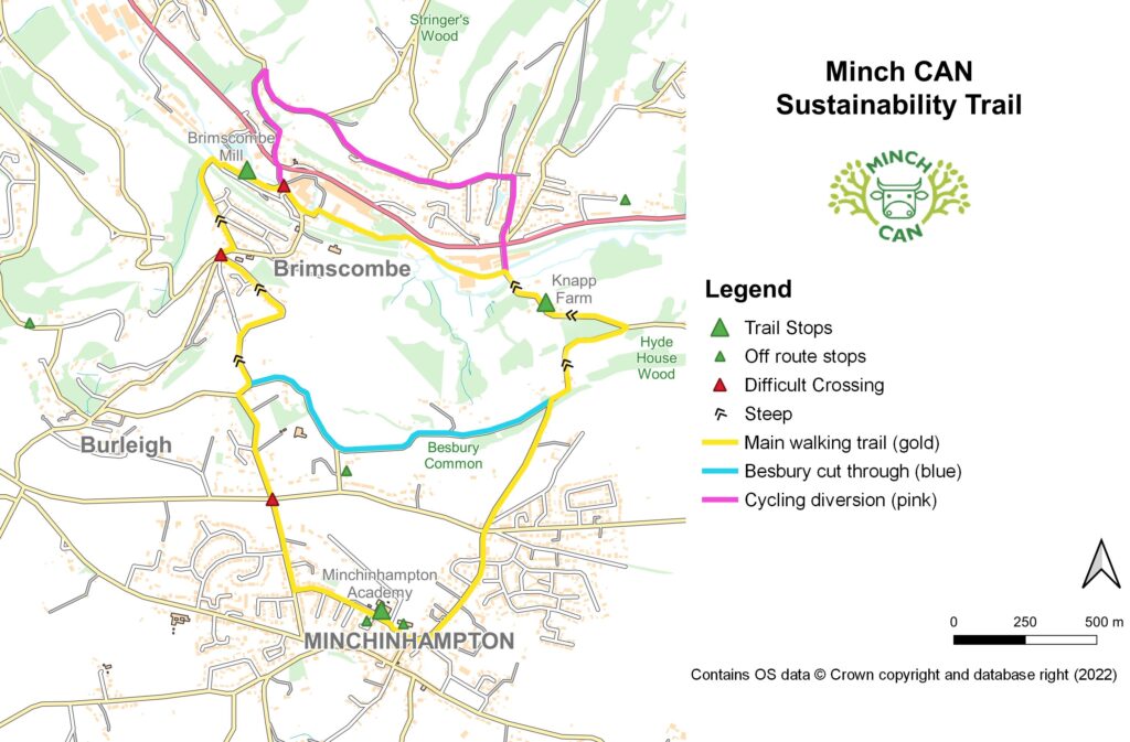
Main walking trail (gold)
The Gold loop is the main 6km long trail.
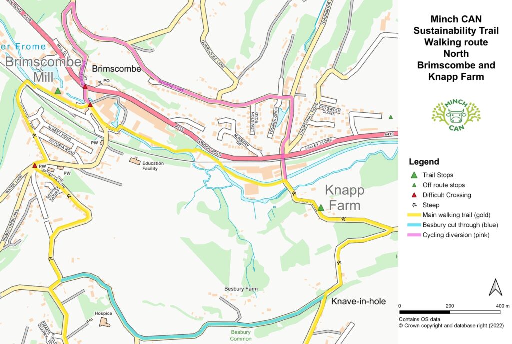
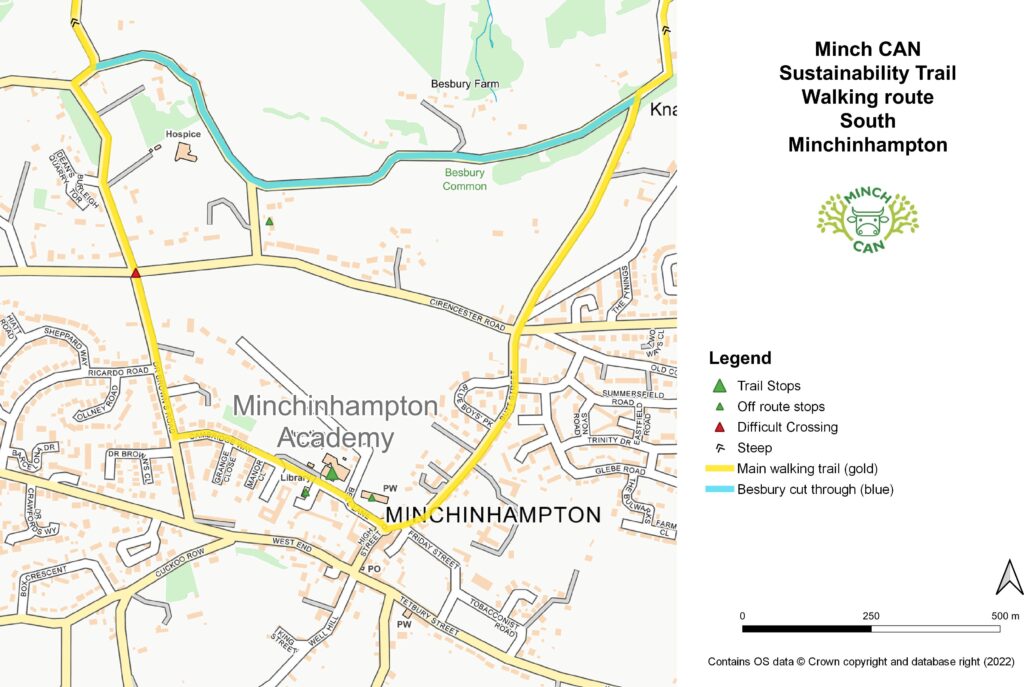
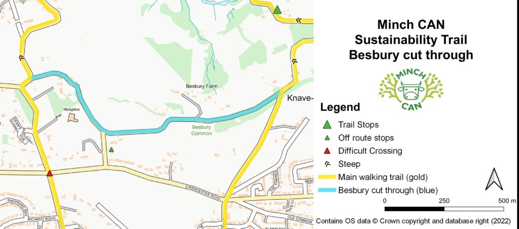
It can be difficult crossing over Brimscombe Hill, London Road and Cirencester Road (red triangles). They’re busy and Brimscombe Hill is also winding, so you don’t see traffic until it’s very close by. There’s a pelican crossing over London Road near the Brimscombe Mill end, and Knapp Lane goes under London Road at the Toadsmoor end.
It’s steep going (black chevrons) between the canal and the Besbury cut-through.
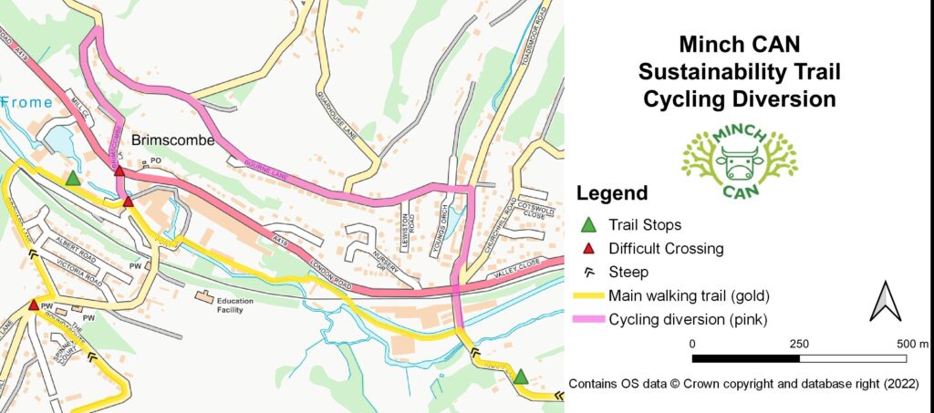
Cycling diversion (pink)
Bikes aren’t allowed along the river between Brimscombe Port and Knapp Lane, so will need to take the Pink diversion. There’s still access to Bourne Mill for Felt Cafe and so on off London Road, but that is busy. It’s just as steep getting up the north side of the valley as it is the south side, but at least you don’t need to climb for as far.
Walkers are still welcome to do the Pink diversion.
Besbury cut-through (blue)
The Blue cut-through takes you across Besbury Common, which is lovely, and also means you can do a shorter circular walk, either the south loop (Minchinhampton) or the much more energetic north loop (Brimscombe and Knapp).
0 Comments